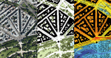
The “ESRI 2015 prize for geographical excellence” was awarded to Apur on 7th October this year. This prize comes as recognition for the quality mapping and GIS work that Apur has carried out over the past 25 years. This work, which is today evolving on both the levels of Paris and the Metropolis of Grand Paris, has established a solid base of reference data on a metropolitan scale in the context of wide ranging institutional partnerships, notably with the National Institute for Statistics and Economic Studies -Insee-, the Ile-de France Regional and Interdepartmental Department of Infrastructures and Development -DRIEA- and the Ile de-France Urbanism and Development Institute -Iau- Idf-.
As part of the prize-giving event, a documentary film was made (by Xavier FODOR, chief-editor of the company SIGMAG), which explains the tools and uses developed over time at Apur by its expert geomaticians, map-makers, architects, engineers…
The documentary particularly aims to show how geomatics is used for flagship projects, such as the BD project or the Observatory on the Grand Paris Station Neighbourhoods.
Let us remind you that this work is accessible online on the cartographic portal CASSINI developed with ArcGIS. If one starts navigating intuitively CASSINI makes it possible to travel through time and subjects, among the many development plans for Paris, from the Abbé de la Grive (1728) to those of the future. Each parcel of land is documented, offering an opportunity to discover how the city has evolved, allowing one to understand its history, the evolution of gardens, streets, infrastructures or to explore dozens of other combinations in just a few clicks.


