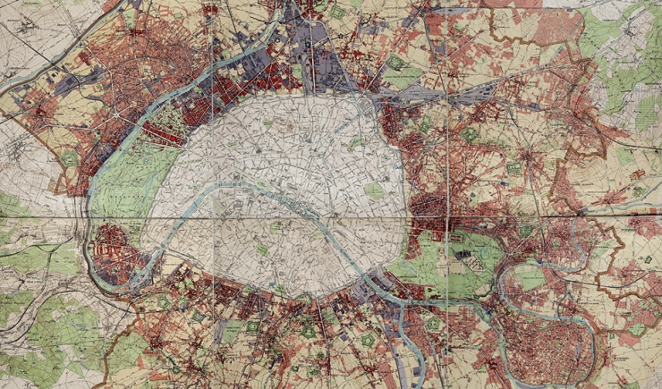
Presentation of the new interactive tool offering a chronology of old maps of Paris and its surroundings from the 18th century to the present day. The plans, from that of the Abbé de la Grive (1731-1741) to the current plan, reflect the urban evolution of the Parisian metropolis (Cassini, Chasses du Roi, Verniquet, Vasserot, Piquet, Etat, Lefèvre , parcel plan of Paris, municipal atlas of the Seine department and successive topographical maps). Each plan is accompanied by reading material allowing it to be contextualized and chronological benchmarks explaining the facts of society and the contemporary urban development work of the plan. The application also makes it possible to superimpose at any time the structural elements of the current plan (buildings, parcel boundaries, islands, administrative boundaries, etc.) or even the historic walls of Paris, with a personalization of the rendering so that everyone can have a reading which suits him best. We will present this application with a historical contextualization, as well as its development, its technical realization and its functioning.
Speakers: Christiane Blancot and Hélène Impini
Access Requirements: To be an Esri customer and to register for the conference
Registration: https://sig2020.esrifrance.fr/programme/5f3fe40e96043c37ff1cd70c

