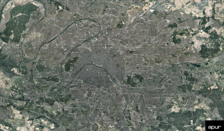
With almost 7.2 million inhabitants and around 3.9 million jobs, the Greater Paris - Grand Paris Metropolis - accommodates six inhabitants out of ten and seven jobs out of ten in Île-de-France on only 7% of its surface area.

With its 360 million square metres of built up areas, (87% of the ground surface is constructed) it offers a unique urban landscape whose main underlying structure is inherited from the royal hunting grounds and heritage construction of the 19th and 20th centuries : Haussmannian configurations, large industrial and military buildings among which are forts, major modern facility constructions and buildings such as stations with their bridges and viaducts, canals and their factories and emblematic institutional buildings of the Republic - town and city halls, and schools of Jules Ferry. The 20th century invented new types of urban complexes, which have now become heritage sites for their architectural quality and exceptional character, garden cities (37 housing estates) and low rental housing - HBM -, housing designed by great modern architects, major facilities. Today 4,139 buildings, estates and complexes are protected as historical monuments to which are added dozens of buildings listed and protected by municipalities. Individual housing occupies the greater part of the metropolitan land (23.3%, 21,000 ha), followed by collective housing (17%, approximately 14,000 ha) and open ground with artificial ground surfaces: urban green spaces, open air sports grounds, brownfield sites, gardens, cemeteries… (16%, approximately 13,000 ha). Surface areas occupied by business activities represents about 10% of the territory i.e. 9,000 ha, those occupied by transport also 10%. Forests cover 8%, 6,300 ha, agricultural land about 2,200 hectares and semi-natural environments and water a surface areas of around 2,500 hectares.
The metropolis concentrates nearly 60% of the surface area given to collective housing in the region and between 30 to 40% of areas dedicated to businesses and those devoted to Île-de-France facilites. The redefinition of all these urban fabrics is important, on the one hand they play a major role in the image of the city and towns and embody their history and on the other hand, 7 out of 10 housing units were built before the 1970s and the need in terms of thermal renovation of buildings is considerable. 10% of the detached housing fabric is modified each year by extensions or heightening.
By 2030, the whole of the territory will have access to new connections linked to the opening of the Grand Paris Express network (200 km equivalent to the already existing metro lines), the updating of RER lines, the extension of metro lines and the creation of numerous tramway lines. The average travel time will be 30 minutes where today it often takes over an hour.
