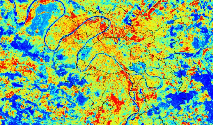
Satellites enable the collection of precious information on the climatic behaviour within territories; The infra-red thermography taken during the summer of 2010 by the satellite LANDSAT brought to light the surprising climatic contrast within the metropolitan territory. The industrial zones, railway land holdings and very dense residential neighbourhoods heat up very quickly in summertime and accumulate heat from the sun all day long. They form urban heat islands which are characteristic of large conurbations. Conversely, places where there is water and vegetation are the only really cool zones in the city. These places where one can breath are therefore considered as essential elements in urban development, they are one of the possible solutions for adapting the city to summer heatwaves.
