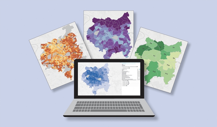
Population, economy, living environment… Apur has put the collection of Data Portrait maps online enabling everyone to use them to gather information on and form a picture of subjects of their choice. Over 70 indicators grouped under 6 themes, coming from 22 different statistical sources are made available.

Publication of the cartographic collection of Apur’s Data Portraits
In order to facilitate a greater awareness of Metropole du Grand Paris, its territories, communes and the 20 Parisian districts, Apur has put the cartographic version of Data Portraits online. A datavisualisation for observing dynamics, comparing and visualising populations linked to any particular subject.… This tool brings together 70 key indicators grouped under six themes: Demography-Society, Households-Families, Accommodation-Housing, Unemployment-Integration, Economy-Employment and Living environment.
Indicators on the maps are on the French Institute for International and Strategic Affairs - IRIS- scale of communes and territories. They can be displayed in 3 modes:
- Number, enabling one to know the amount within a chosen sector (e.g. the number of people under 20 in a district, commune, territory);
- Ratio of a sector of the population informing one of the structure and “influence” of each category (e.g. the ratio of under 20 year olds in relation to the total population in a district, commune or territory);
- The evolution showing the tendency over the recent period of 5 years.
Sources
Twenty-two statistical sources are used among which is the census of the National Institute for Statistics and Economic Studies -Insee-. There are also sources on the economy and commerce (Job Centre -Pôle Emploi-, French Annual Declarations of Social Data -DADS-, the National Business Directory -Sirene-), housing (Directory of the Social Housing Stock -RPLS, Ministry of Housing, Regional and Interdepartmental Department of Accommodation and Housing -Drihl-), the population and social services (Civil Registry, National Child Benefit Office -Cnaf-, National Statistical Incomes Directory -Filosofi-), health (Regional Health Agency -ARS-), the environment (Paris Fire Brigade -BSPP-, Ile-de-France Air Monitoring Association -AirParif-) and transport (Ile-de-France Transport Syndicate -Stif-).
The Data Portraits can be accessed on the Apur site by clicking here.
The first part of Data Portraits is also available online. Published at the beginning of the year it enables one to obtain all the accessible data on a commune or territory.
Press contact: Quentin Treton : mail – 01 83 97 63 59


