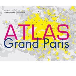
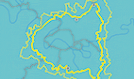
2013 Atlas of Grand Paris

The Atlas of Grand Paris 2013 is a contribution that supports cultural differences and the understanding of identities within the metropolis. It is also an opportunity for the reading of our maps and data to be shared. They are intended to enrich the expertise of researchers and facilitate the growing place of citizens in the life of the city.
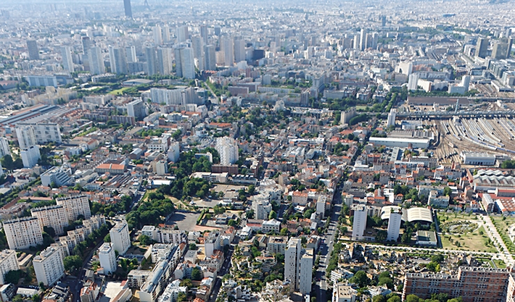
View over Ivry and the metropolis © Ph.guignard@air-images.net
“The Atlas has this quality, it reveals the shape of cities which have no shape yet nor name.”
Italo Calvino, Les Villes Invisible, French edition published by Gallimard
In a few years time the political and administrative landscape of the Parisian metropolis will have changed greatly. A metropolitan project will have been instigated, which will hopefully affirm our differences. One need only hear how each person today describes their Grand Paris, whether they live in Paris or on the Montreuil hillside, work at La Défense or Massy Palaiseau to see how each commune and each neighbourhood asserts its identity. For all that, a perceptive visitor may be surprised at how the projects being carried out all resemble each other – and how, without it having really been decided, we are reducing the differences within our territories with rules, norms, taking into account limitations and constraints and the execution of projects. The singularity of places, so precious, so loved, painted, drawn, is disappearing.
 
The 2013 Atlas of Grand Paris contributes to cultivating awareness of these differences, and to understanding of the metropolis' identity. It is also an opportunity for the reading of our maps and data to be shared by those wishing to enrich their knowledge  with researchers' expertise and to facilitate the ever growing place of citizens in city life.
 
A set of three essential “identity cards” have been put together, street maps/maps, points/squares and lines/walks, which make reference to the fundamentals of visual art as defined by Kandinsky. The “deck of three cards” has no hierarchy, all are equally important and constructive when analysing the territories. They are for us a means for enriching  projects.
 
Michel Lussault and Patricia Pelloux have explored “sustainable” geography maps. Through playing with scale they lead us to discover a metropolitan city whose richness lies in its complexity, which is built out of its heteropolarity.
 
Alexandre Labasse and Christiane Blancot are our guides in choosing the urban fabrics and squares of 400x400. They allow us to play a game of differences, comparing the diverse architecture, urban forms and the sameness of what is happening.
 
Paola Viganó and Jean Christophe Choblet have walked the length and width of metropolitan areas, they invite us to discover the metropolis' invisible boundary lines and how walking, as part of the project, can recreate links between these areas. 
Frédéric Gilli has tackled the task of portraying the -Grands Parisiens-.
 
A simple choice, a shared reading is at the service of the infinite diversity of Grand Paris. François Maspero1, in his publication which tells the story of his exploration along the RER B line, speaks of how time is essential to understanding:
“Even if today the majority of France's population lives in the suburbs (. . .) and that these city centres are but pale survivors of almost prehistoric times and a fragile window onto modern times. We have plunged into the unknown. The unknown where we all live. It was simple. One had only to think (. . .) everybody can do that. It demands as much attention as compiling a family album. A little willingness, a little time above all.... But one is led to believe that these people don't have the time.”
Time for a cultivated diversity, the 2013 Atlas of Grand Paris expresses this wish. With their maps/street maps, their squares/points and their lines/walks, the identity maps proposed do not stand alone, they are our contribution in 2013 towards the right to be different in Grand Paris under all circumstances.
 
The Parisian Urbanism Agency (Apur) has the mission to carry out a study and an analysis of the urban and societal evolutions which play a part in defining public policies. Over 85 geomaticians, cartographers, engineers, sociologists, architects, geographers, economists, statisticians have worked on and contributed to the drawing up of projects for Paris and the Parisian metropolis. Apur is today as much involved in making up data and maps  which are accessible to everybody as being a platform for all those active at the heart of the conurbation to conceive and exchange on planning ideas.
 
We have been making maps of Paris, the inner ring of suburbs, Grand Paris and the metropolis as a whole for over half a century in accordance with the terms used at the time.
 
1Extract of François Maspero's  publication p. 335/336,  Les passagers du Roissy-Express – published by Seuil, September 1990
 

Table of contents:

Editorial, Bertrand Delanoë, Mayor of Paris

To represent the metropolis, a political choice, Pierre Mansat, Deputy Mayor of Paris, responsible for Paris Métropole and Local Authorities on the Territory

Introduction: Identity cards, Dominique Alba, architect, Managing Director of Apur

Book 1. Points of reference

Book 2. A paradoxical geography, Michel Lussault, geographer, University Professer and Patricia Pelloux, Metropolitan and Large Territories Manager at Apur

Book 3. A lived in metropolis, Alexandre Labasse, architect, Managing Director of the Pavillon de l’Arsenal and Christiane Blancot, Cities and Urban Forms Manager at Apur

Book 4. Walks in Grand Paris, Paola Vigano, architect, PH.D. in urbanism and Jean-Christophe Choblet, urban designer at Apur

Portrait: Representing the “Grand Parisians”, Frédéric Gilli, geographer and PH.D. in economy

Biographies, bibliographies and thanks
 

This issue of the review is no longer available in paper version but can be downloaded on this page. 

 
The content of downloadable work in digital format is intended for strictly personal and private use that is free of charge.  Apart from cases provided for by the legislation in force, any reproduction,  adaptation or representation in any form, medium or by any means of any kind, particularly the sale, exchange, renting or transfer to a third party are forbidden unless specific, prior authorisation has been given by Apur  

Resources

Documents to download

  • Paris projet

    Atlas du Grand Paris 2013

    Format : pdf, 233.5 MB
    Download

External links