(2023 Edition) Culture plays an essential role in the dynamism and attractiveness of Grand Paris. In order to document its wide diversity better, the Agency has published the 2023 Atlas of Cultural Venues in Grand Paris, in collaboration with the Ile-de-France Regional Directorate of Cultural Affairs, the Grand Paris Metropolis (Métropole du Grand Paris) and the Société du Grand Paris.
What does the metropolis’ cultural offer represent in the economy? How is the offer distributed geographically? Who are the key players and governing bodies involved? How does the arrival of new mobility offers necessitate that this ecosystem reinvent itself? How is the cultural sector adapting to societal, digital and climatic challenges? What are the new modes of access to culture?
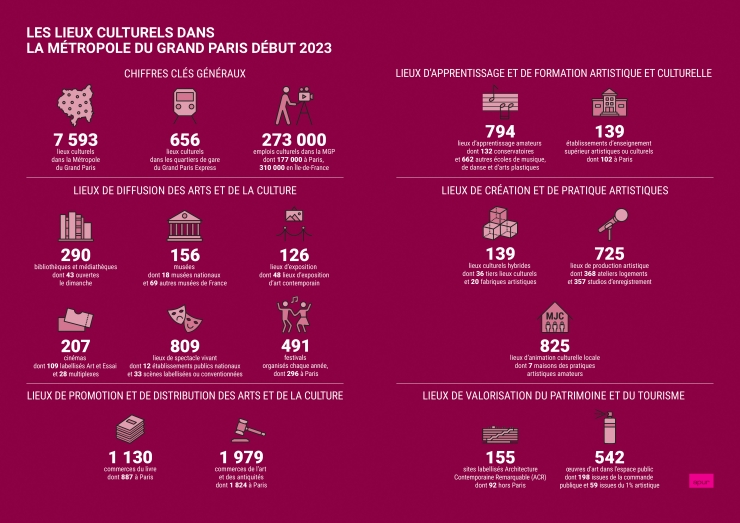
The Atlas of Cultural Venues in Grand Paris paints a picture of an exceptional offer, listing over 7500 places where cultural and artistic activities are diffused, practiced or produced. This new edition follows on from the first atlas published in 2015, whose data has been updated and enriched, revealing a wide range of places, museums and exhibition spaces (282), libraries and media libraries (290), cinemas (207), live performance venues (809), heritage and tourist sites, book shops, (1130), art businesses (1979) as well as emerging spaces, which show today’s cultural practises and production, such as hybrid spaces (139 third places, artistic fabrication, Micro-folies), artistic learning and training spaces (933), artistic production and activity (1,543) and finally art in public space and festivals (491).
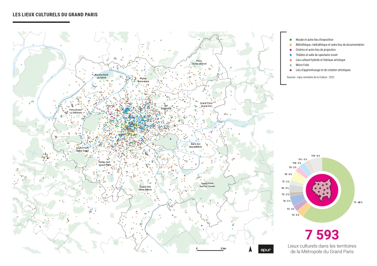
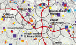
In this 2023 atlas, cultural sites are represented on three distinct scales: Grand Paris Metropolis, the 12 metropolitan territories and the 68 Grand Paris Express station neighbourhoods.
The latter part of the atlas explores the evolution of the cultural sector in Grand Paris Metropolis in a forward-looking perspective: its weight in the economy, which needs to be strengthened and coordinated with 273,000 jobs; its governance, looking at the role played by the State and local authorities and the way it is articulated with associative and private players; its networking which will be facilitated by the new mobility offer of the future; how it can adapt to societal, digitalisation and climatic issues and finally the central question of access to culture and artistic disciplines. A series of interviews with public, associative and private cultural key players on the territory made it possible to go further into these lines of enquiry. They point to ways for developing and strengthening the central role of culture in Grand Paris’ standing.
The Atlas can be consulted in a catalogue version and as a data-visualisation, thus making it possible to arrange, discover and filter, the 7,593 references in the municipal communes and territories, by types of place and geographical location. The entire atlas is also available on open data to serve as a common basis for other studies.

