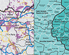
A few months ago, Paris Métropole published a cartographic collection of new inter-communal dynamics as of January 1, 2016. This document, the result of the efforts of its work group “Territorial connections”, was forwarded to all the Mayors and Presidents of the inter-communalities in the Paris conurbation and has received many positive responses. The goal has been achieved: public authority representatives have been able, via this publication, to place the particular characteristics of their territories in the new institutional landscape. The Metropolis, its Public Territorial Establishments (EPT) and the rationalisation of the inter-communal map of the outer suburbs have in fact created new boundaries for the territories, meaning that from now on they will have to rebuild their image and their identity.
Public authority representatives, working on defining their new territorial projects, had requested Paris Métropole to go further: they wanted their thinking about territorial dynamics to develop at commune level, there where the real driving force of each inter-communality lies. This second publication aims to respond to this demand.
For this second publication and within the framework of their respective work programmes, Apur and the Ile-de-France Development and Urbanism Institute (IAU-IdF) have contributed their valuable territorial expertise to the work in hand.

