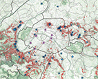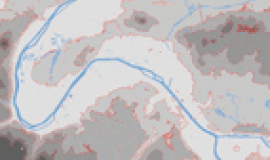
How far can one see from Paris and which territories include Paris in their landscape? What are these shared landscapes that we have inherited? What is their composition? On a metropolitan scale, what shared tools could facilitate the management and regeneration of these landscapes without diminishing their present qualities, but rather enriching them with new features which will form part of the future identity of the metropolis?
This study aims to respond to these questions by identifying the features making up the shared landscape of Paris and her neighbours, and then putting forward ideas for new, purpose-built and user-friendly tools for building metropolitan landscapes, which can also be used to measure the impact of future projects on existing landscapes.
We chose the heart of the metropolis as a testing ground for these tools for reading landscape, because that's where the elements which are the most iconic and most identified with the landscape of Paris are situated, such as the Butte Montmartre, the Eiffel Tower, the Montparnasse Tower, the Arc de Triomphe and all the many cupolas and bell towers...not forgetting, outside the administrative boundaries of Paris, La Défense, the Pleyel Tower, Mont Valérien, the Roumainville Tower ...
These methods could be developed into metropolitan management tools for transforming the landscapes of urban conglomerations, for the use of everyone involved in development, be they designers, decision-makers or simply inhabitants.
Contents
- Introduction
- Delineation of the land shared by Paris and her neighbours
- Panoramic viewpoints and overall landscape features
- Landscape in regulatory documents
- Tools for understanding landscape transformation
- Conclusion


