-
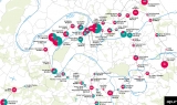
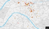
 Map
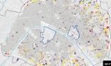
MapThe Grand Paris Metropolis Solar Registry
September 2021 -
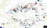
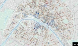
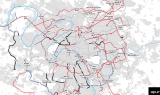 Map
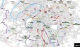
MapRecently completed public transport services and those planned within the Greater Paris - Grand Paris Metropolis
September 2021 -
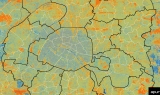
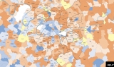
 Map
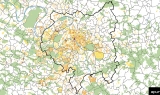
MapHuman density (population + salaried jobs) in the Grand Paris Metropolis
September 2021 -
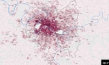
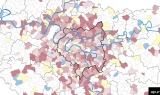
 Map
MapPopulation density in the Greater Paris - Grand Paris Metropolis -
July 2021 -
 Map
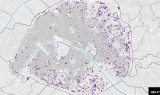
MapSRU Social housing landlords in Paris
July 2021 -
 Map
MapSocial housing in Paris as defined by the SRU Law
July 2021 -
 Map
MapPublic transport projects in the Greater Paris - Grand Paris Metropolis -
June 2021 -
 Map
MapHeavy public transport lines put into service between 1976 and 2020 in Ile-de-France
June 2021 -
 Map
MapRoad traffic restriction zones throughout the Greater Paris - Grand Paris Metropolis
June 2021 -
 Map
MapState of play of development projects in the 68 Grand Paris Express station neighbourhoods (surface areas in %)
May 2021 -
 Map
MapProgramming development projects in the 68 Grand Paris Express station neighbourhoods
May 2021 -
 Map
MapPopulation trends between 2013 and 2018 in Greater Paris - Grand Paris
April 2021 -
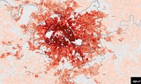
 Map
MapAnnual change in mortality between the 2015-2019 average and 2020 by municipality (and Parisian district)
April 2021 -
 Map
MapEndangered buildings in Paris in 2020
April 2021 -
 Map
MapCommercial facilities in 2020
April 2021
Our works
Find here all Apur’s productions, Studies, Notes, Summary Reports, Datavisualisations, etc.
Your search
111 results