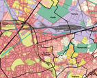
As a follow up on work begun in 2010 on the « urban project database”, all the local urban plans (PLU) for communes in the heart of the Parisian conurbation have been checked. This study presents the first part of our work, the monitoring of PLUs for Paris and 21 communes situated to the north and east of Paris, namely: Aubervilliers, Bagnolet, Bobigny, Bondy, Drancy, Fontenay-sous-Bois, la Courneuve, le Bourget, le Blanc-Mesnil, les Lilas, les Pavillons-sous-Bois, le Perreux-sur-Marne, le Pré-Saint-Gervais, Montreuil, Nogent-sur-Marne, Noisy-le-Sec, Pantin, Romainville, Rosny-sous-Bois, Saint-Mandé and Vincennes.
Examination of PLU regulations monitor the zoning of urban rules within communes. A simplified map of the PLU zones was made showing areas affected by different urbanization principles within their territorial boundaries. The study looks at structural and density regulations, with maps made to facilitate assessment of these themes. 14 sections are involved, which address the building to plot ratio - coefficient d'occupation du sol (COS)-, 10 are related to the height of building and 9 to the surface area which is built upon. A more detailed analysis of particular zones was also made: residential areas, housing schemes, town and city centres, densely urbanised areas and business zones.

