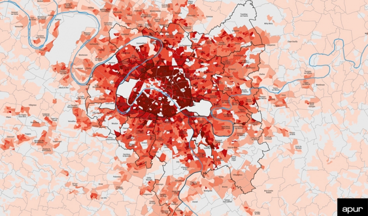
This map shows the net population density per hectare on an infra-municipal scale (Iris: groups of street blocks for statistical information). The number of inhabitants given by the 2017 population census is related to the Iris surface area from which the theoretical surface area with no inhabitants (roads, facilities, green spaces) has been substracted. Iris considered as non-significant by Insee (imprecision of data due to the particular structure of Iris: professional and leisure activities, for example), is excluded from the map.
