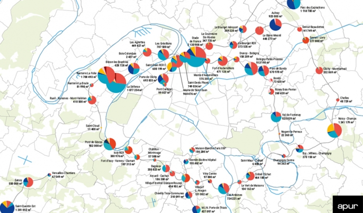
The map shows the schedules of all development projects in each of the 68 Grand Paris Express station neighbourhoods. The development projects included are those with a surface area of over 2 hectares, whose completion date is post-2013 and where the compilation of data transmitted by developers and local authorities was completed in March 2021.
These programs, shown in m2 of the floor surface area, are classified under 6 categories: housing, offices, activities, facilities, shops and hotels. Each station neighbourhoods is defined by a 800 metre radius around a future Grand Paris Express station.

