CASSINI : cartographic portal on a metropolitan scale detailed to land parcels

cartographic portal on a metropolitan scale detailed to land parcels: extract

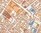
The Parisian Urbanism Agency has launched a cartographic web application CASSINI (Apur Consultation of the Spatial Server via Internet and Intranet), which enables everybody to consult a collection of data on the Parisian metropolis, with geographic reference data, historical maps, regulatory data and in the near future, social, economic, statistical and environmental data as well as that linked to development projects. The very precise detail makes it possible to explore each parcel of land historically, in the present day and its possible evolution in the future. This tool has been developed by the Parisian Urbanism Agency, Apur, in partnership with the City of Paris, the Departments of Hauts-de-Seine, Seine-Saint-Denis and Val-de-Marne, the Paris Fire Brigade, the Public Finance General Directorate, the Paris City Transport Authority, RATP and the companies ESRI and InterAtlas.

It offers intuitive navigation with “layers” of data and scale variations going to 1/500. CASSINI allows one to travel through the centuries and the different Parisian development plans since the Abbé de la Grive map (1728) up to the present day, to see the metropolis' public facilities detailed to land parcels, to superimpose the layout of contemporary buildings over a historical map or operate the dozens of other combinations in a couple of clicks.
The tool also integrates various view points and a link to Street View. Each data item is documented (source, dates of updates, compilation procedures, etc.)
It is accessible now, these reference data and historical plans will gradually be completed with statistical and environmental data, followed by data on development projects.