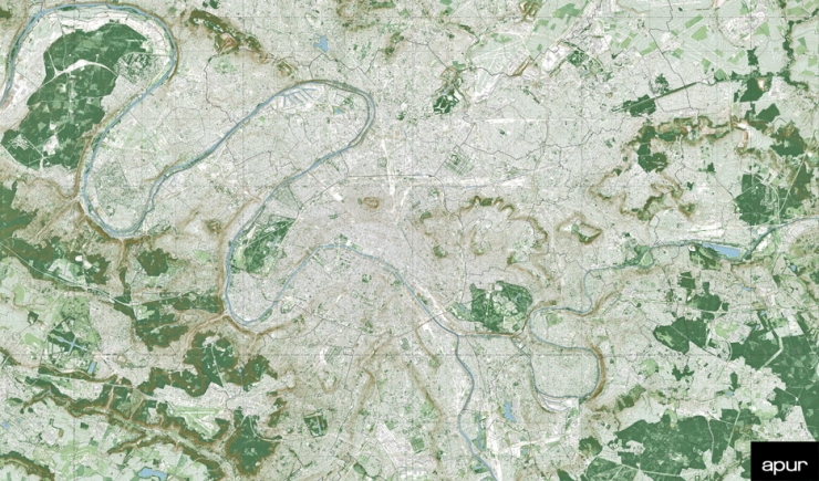
The meandering valley of the Rivers Seine, Marne and Oise have shaped the landscape. Its multitude of hillsides slope gently down to the rivers from the plateaux that form many lines along the horizon. From there, depending on if one is at the edge of the Plateau of Romainville or Aulnoye, on the Mont Valérien or the terrasses of Montmartre or Saint-Germain, the urban fabric stretches as far as the eye can see, punctuated here and there with points of reference, which enable one town or area of the city to be distinguished from another: the Pleyel tower, the Eiffel Tower, the Hertzien Tower, the Observation towers, the tower districts - Quartiers de Tours -, the Pantheon, Basilique and hospitals, steeples and belfries…
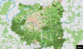
At the edges of this immense built-up area, the forests and woods follow on one after the other forming a huge, metropolitan, green belt from the forest of Bondy to that of Notre-Dame, from the woods at Boulogne to Saint-Germain forest, from the Meudon woods to the forests of Malmaison, Fausses-Reposes and Marly. Beyond, lies the agricultural land of Ile-de-France.
Nature (woods, parks, gardens) occupies 20% of the surface area of the metropolis that is 12,220 hectares. The surface area of green spaces open to the general public is approximately 17.4 m²/inhabitant (London 45 m², Brussels 59 m², Madrid 68 m², Bordeaux 25 m²), this ratio generally hides widespread disparities with the centre of the metropolis lacking available green space for its very dense population. About 27% of the metropolitan population suffers from a lack, in terms of access to a public garden or park.
Nature in Grand Paris Metropolis takes various forms: 16 forests, woods and parks of over 75 ha covering 10% of the territory (7,900 ha), 59 parks and gardens of 15 to 75 ha covering 2.3% of the territory (1,660 ha), 604 parks, gardens and promenades of 1 to 15 ha covering 2.3% of the territory (1,840 ha) and finally 3,581 parcs, gardens and promenades of under 1 ha covering 1% of the territory (820 ha).
Added to this are the greenways - Les Coulées Vertes - and planted promenades linking parks, gardens, forests and the great agricultural plains in the region with notably: the South Parisian greenway and the Vallons-de-la-Bièvre promenade that runs alongside the Atlantique TGV for 11 km, paths in Parks, greened pathways which connect the Courneuve Park all the way to the River Marne, the Tégéval greenway interconnecting the TGV between L’Île de Loisirs at Créteil and the Grosbois Forest, the Gennevilliers greenway between the parks of Chanteraines and Île-de-Robinson, the planted land of La Vanne Aqueduct, the Ex-VDO land, the Dhuys promenade, the greened banks of the Seine, the Marne and the canals… and almost 400,000 private gardens located principally in detached housing residential areas.
Agriculture has continually withdraw in the metropolitan territory and today occupies only about 2,000 ha mostly located in the north-east and south-east of the territory. To develop urban agriculture in order to reduce the metropolis’ food dependancy, is now included in numerous local authority policies with funding available to create urban farms and greenhouses, to protect still existing agricultural land and to set up new modes of production that are more ecological than the cereal farming practiced up until now.

