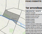
The Paris Urbanism Agency has produced a new tool for statistically describing Paris’ 20 districts -arrondissements-. This responds to the Parisians’ desire to be able to consult raw data of their own accord.
About 70 key-figures are presented on themes such as demography, the family, housing, unemployment and integration, the economy, living conditions…
We find for example the number of social housing units, of births, of job seekers, and doctors, the % of the population exposed to nitrogen dioxide, the number of accommodation facilities for elderly people, etc.
The most recent versions of sixteen statistical sources have been used including the Insee census but also economic and commercial sources (the unemployment agency -Pôle Emploi-, automated social data source -Dads-, the business identification listing -Sirene- and Bdcom), housing (the rent observatory -Olap-, the Chamber of Notaries, the urban solidarity and renewal -SRU- listing) and social (the French Social Security and Child Benefit Office -Caf de Paris-).
Files will be updated yearly, in the autumn, with new information added resulting from partner demands or contributions from new Apur studies.
A detailed portrait of the social section is being put together at the moment by the City of Paris Department of Social Action, Childhood and Health. This statistical tool will be completed by next June.


