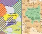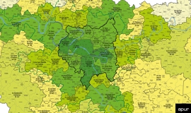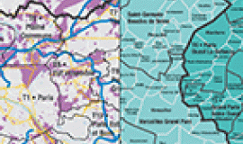
Carried out by Apur and AU-IdF, this document is intended to facilitate the dialogue between elected representatives in the “Perimeter” group of Paris Métropole, by showing, without claiming it to be exhaustive, the future territorial dynamics which will be brought about by the institutional reform in Île-de-France. The cartographic data will be presented on the scale of future intercommunal groupings. In the inner ring of suburbs - La Petite Couronne - the boundaries of public territorial establishments have been maintained, in order to enable the data to be read on a similar scale to that of the inter-communality in Greater Paris - La Grande Couronne -.
This collection of maps makes it possible now to look ahead at the characteristics of territories under construction. The different themes aim to trigger one’s thinking: what will be the main territorial equilibrium between intercommunal groups? What will be the resources, assets and challenges of different territories? What development coherence should there be between all these territories? What new interaction could be formed in the future?
These themes can be added to in response to what is needed.


